What each machine did in each field, with proof
For growers and farm contractors: from the route of harvesters, tractors and sprayers to hectares, hours and closed orders.
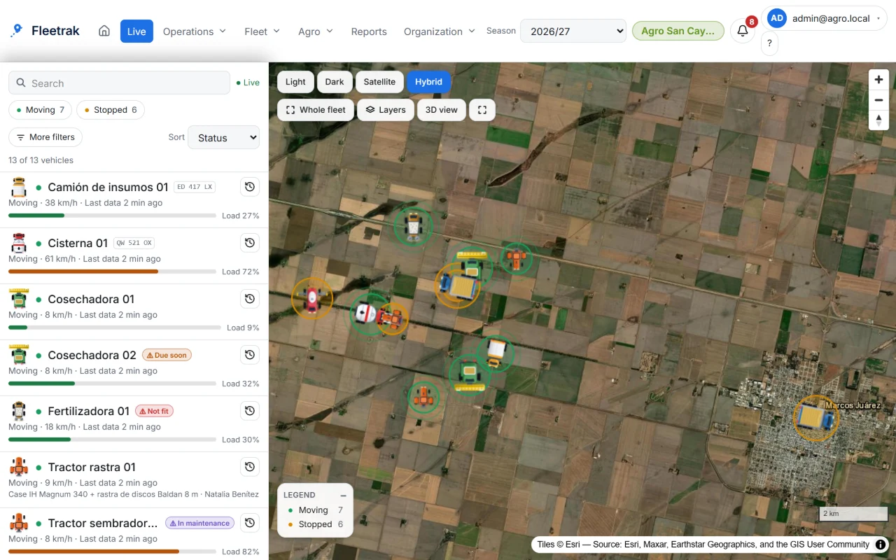
The problem
Farms and rural contractors need to know what each machine did in each field and for which grower, even where there is no signal. Without that record, controlling the work and preparing invoices is done by hand.
What you can do
Hectares worked per field
Work is calculated from the track and implement width, including net area and overlap.
- Coverage drawn over the field
- Hours and hectares per hour
- Inference settings per vehicle
Seasons and fields in order
Organize seasons, assign crop and variety per field and filter everything by season. Import fields from GeoJSON, KML or shapefile.
- Copy the previous season
- Permissions by field or farm
- Colors by progress, area or yield
Work orders
Plan the task, the field and the date window. The system links the sessions and shows what was ordered versus what was done.
- Deviation and suggested closing
- Planned versus applied inputs
- Alerts for overdue or behind-schedule orders
Inputs, fuel and harvest
Input stock with a dose per hectare, fuel per tank and kilos harvested per field.
- Actual versus theoretical consumption
- Tank reconciliation
- Client reports ready to invoice, without prices
Works in the field
The machine works without signal and the app uploads the full route when the connection returns.
- One Android tablet or phone per machine
- Messages between the office and the operator
- Each client sees only their own data
This is what Fleetrak looks like
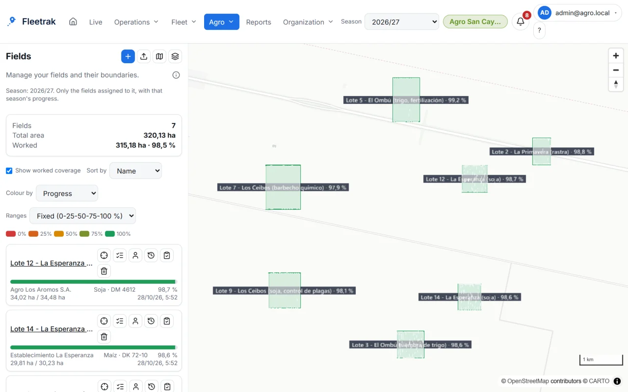
Fields and season with each task’s progress 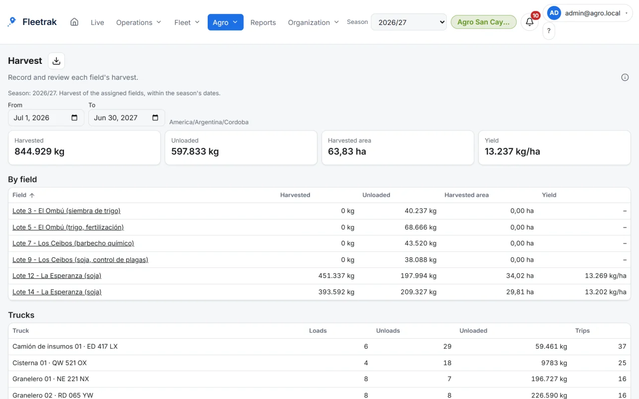
Harvest control and yield by field 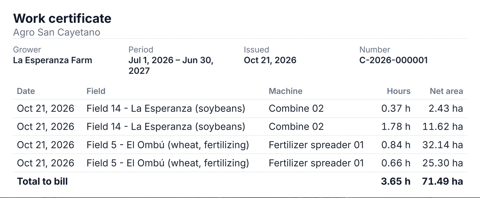
Work certificates for contractors
Screens from the real product with simulated data from the farming demo.
Available today
- Estimated hectares per field and per season, calculated from the machine’s routeWith conditions
- Work orders for seeding, spraying, fertilizing and harvest: planned versus doneWith conditions
- Harvest, applied inputs and fuel, with the supply tanker as a tankWith conditions
- Service report per grower to prepare your invoicing, and per-field access for each user
Not available yet: ask us
- Costs and settlement with prices: the per-grower report does not include them today
- Consumption, dose or kilos measured by the machine itself: GPS does not measure them
A working day, end to end
Plan and assign
You assign a field operation to a machine and its operator, with the date window.
Work and record
The operator works with an Android tablet or phone; the path is saved even without signal and sent when the connection returns.
Review and control
You see the estimated hectares and the progress against the order, with the calculation method in plain view.
Close and report
You close the order and export the report by field or by grower, as CSV or Excel.
Who does what
- Manager or contractor: plans the orders, follows progress and closes the work.
- Operator: works with the app on the machine and receives messages from the office.
- Grower or administration: sees only their own fields and receives the services report.
What was tested and what was not
The hectare inference was tested with a farm simulator and test paths; it has not been calibrated with real field data yet, so these are coverage estimates and not a certified measurement. Orders, inputs and per-grower reports were tested end to end with demo data.
What you need and what to know
- One Android tablet or phone per machine; fields and the width of each implement are loaded beforehand.
- Kilograms and doses are entered by a person or derived from the area: GPS does not measure them.
- The per-grower report does not include prices or settlement.
Frequently asked questions
Does it measure hectares exactly?
They are hectares estimated from the path and the implement width, with overlap discounted. They are not a certified measurement: calibration with real field data is still pending.
Does it work for contractors who serve several growers?
Yes. Each field and each order is assigned to a grower, and the services report comes out per grower, ready to prepare your invoicing, without prices.
Try it with your operation
Create your company and try what is available today, or tell us about your case so we can evaluate the scope.