See where every vehicle is, right now
A map and a list with the status of your whole fleet. It updates by itself and works just as well on your phone.
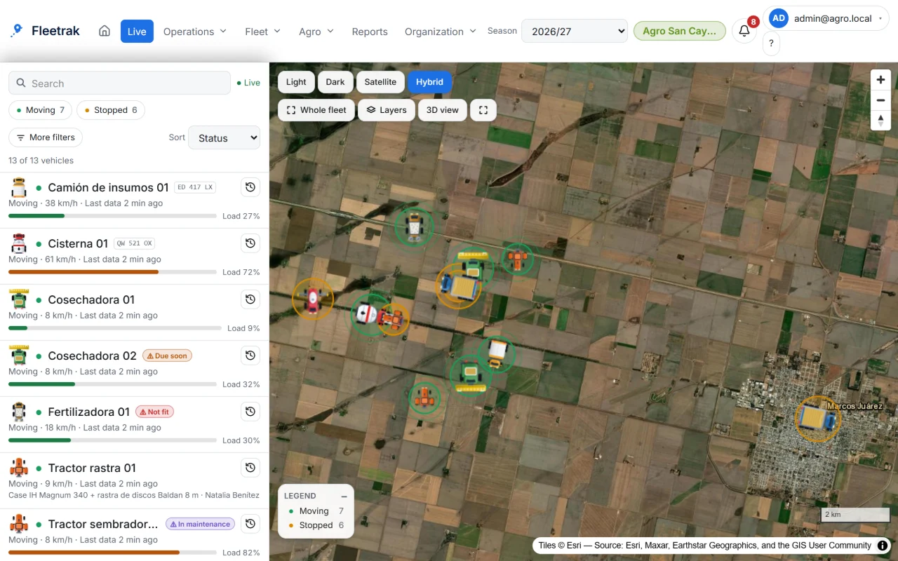
Status at a glance
Each vehicle shows whether it is moving, stopped, offline or has GPS off, and how long ago its last data arrived.
- Filters your browser remembers
- Layers, aerial imagery and full screen
- Tells “offline” apart from “no signal”: what the phone or tablet stored arrives later
Quick actions
Right-click a vehicle, on the map or in the list, to do the most common things without changing screens.
- View history and details, center and follow on the map
- Copy coordinates or plate, open in Google Maps
- Message the driver and see whether they read it
Built for large fleets
The list is virtualized and the map switches to dots when you zoom out, so it stays smooth with hundreds of vehicles.
- Load test with a simulated fleet of 200 vehicles
- Pop-up notice only for new critical alerts
This is what Fleetrak looks like
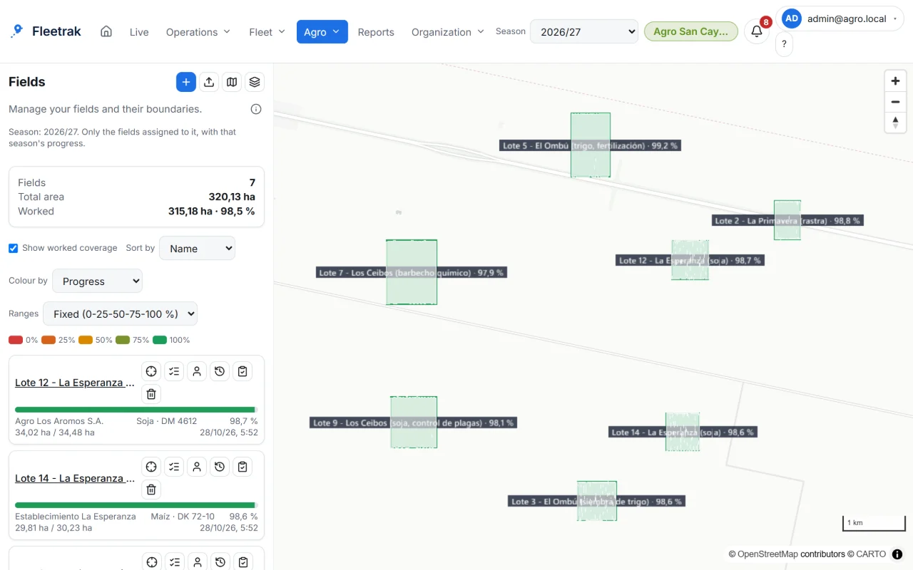
Fields and season with each task’s progress 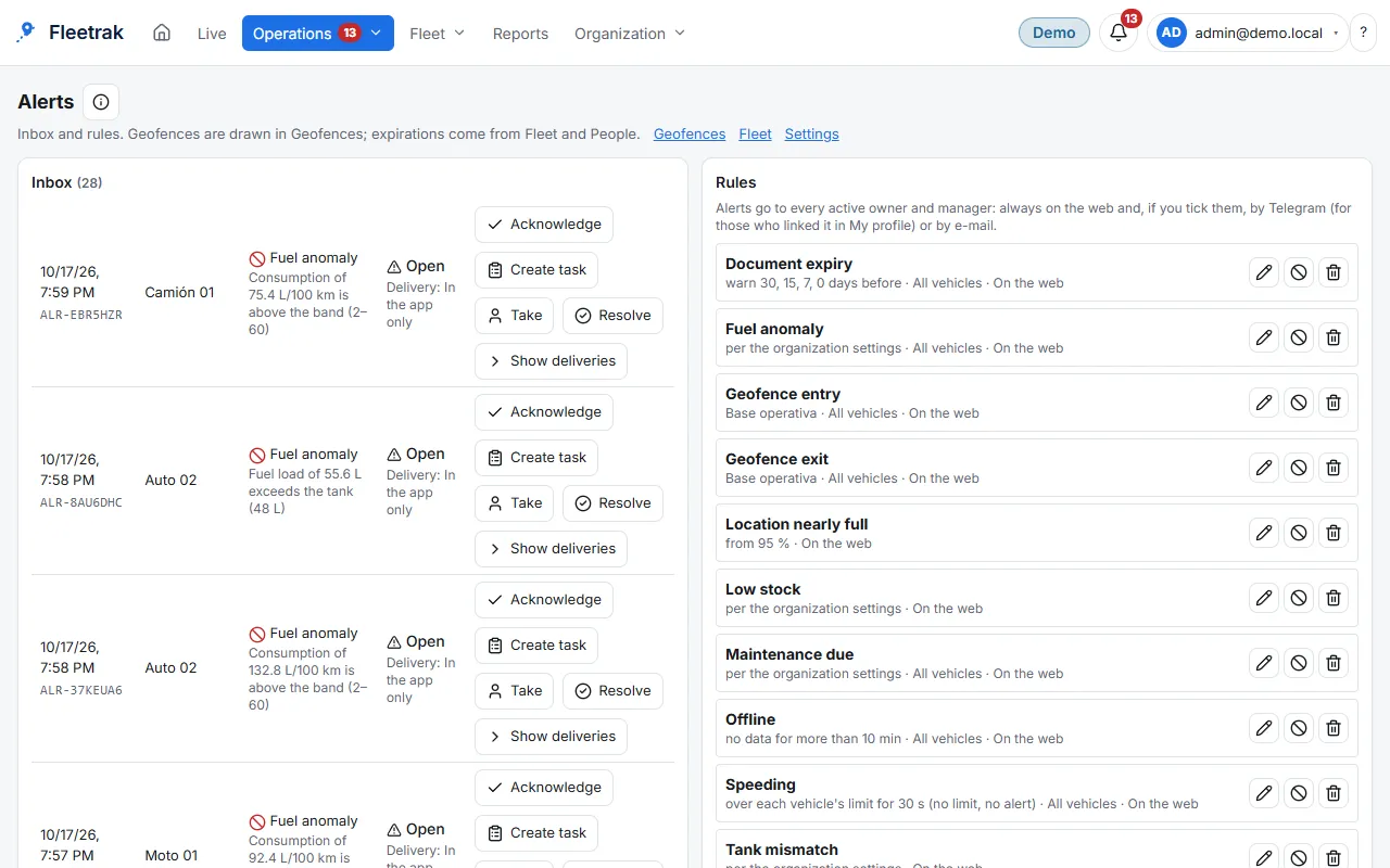
Speed, geofence and stop alerts
Screens from the real product with simulated data from the farming demo.
How you use it
Link a phone
Scan the QR code on the vehicle’s page with the driver’s Android app.
Open Live
As soon as the first point arrives, the vehicle shows up on the map with its status.
Act from the map
Right-click to open the history, message the driver or follow the vehicle on the map.
Try it with your own fleet
Create your company for free, with no card, and link your first phone in minutes.
Create my company